GX-1 Network

The sensor network that trains GAIN.

Every GX-1 sensor in the ground is ground truth for GAIN — cellular soil sensors, sports capsules, and ag towers reporting every ten minutes so the intelligence layer can learn your property.

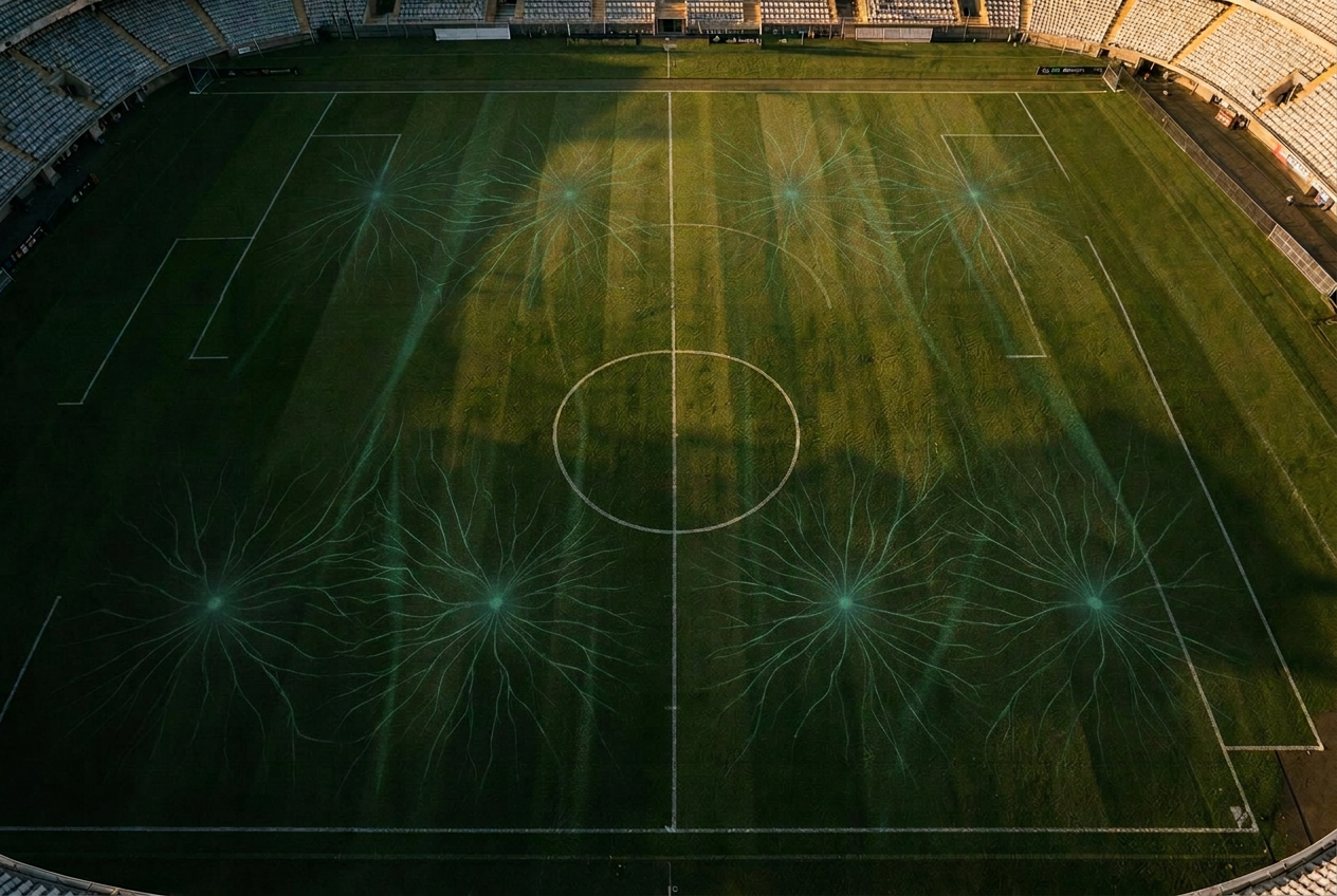
Faint electrical pulses flowing across turf

The sensor family

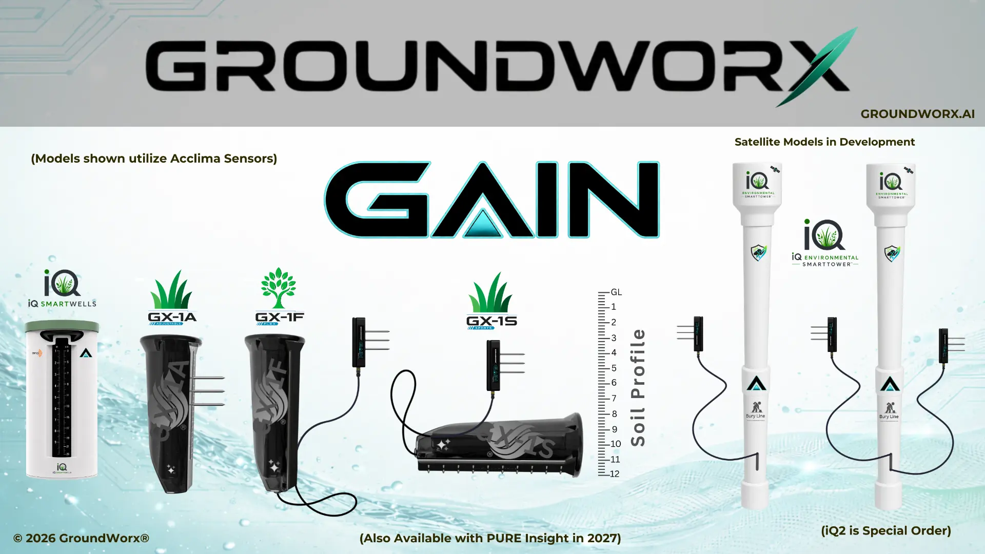
One network, five form factors.

The GX-1A and GX-1F install into a permanent iQ SmartWell housing at each monitored location; the iQ Capsule and iQ SmartTowers are self-contained, standalone units. SmartTowers ship on LTE Cat-1 with an elevation extension for long-range agricultural coverage — direct satellite NTN fallback is in development.

The GroundWorx product family — iQ SmartWells, GX-1A Agriculture, GX-1F Flex, GX-1S Sports, iQ Capsule, and iQ Environmental SmartTowers, with GAIN AI Predictive Intelligence

GX-1A

Available now

GX-1A Soil Sensor

Root-zone sensing for turf, reporting moisture, temperature, and salinity from a 6 inch burial across a 2 to 8 inch profile. Installs into a permanent iQ SmartWell, so the sensor can rotate between locations while each learned location keeps contributing.

GX-1F

Available now

GX-1F Flex Sensor

An 8 inch burial reading a 1 to 44 inch profile, for deeper root systems, drainage studies, and agricultural soils. Like the GX-1A, it installs into a permanent iQ SmartWell housing.

GX-1S

Available now

GX-1S Sports Sensor

A side-buried, omnidirectional sensor built with PURE Insight for athletic fields where nothing can sit under the play surface. Available until the iQ Capsule replaces it.

iQ Capsule

Under development · Target Q1 2027

iQ Capsule

Playing-surface intelligence for greens and athletic surfaces, delivered as an annual intelligence service rather than a hardware purchase. Succeeds the GX-1S.

iQ

Releasing Q1 2027

iQ SmartTowers

Multi-depth soil intelligence for production agriculture at field scale. Towers ship today on LTE Cat-1 with an elevation extension — an elevated antenna mast engineered for long-range cellular across large farmland and rural topography. Direct satellite NTN fallback is in development.

Faint electrical pulses flowing across turf surface

Why it holds up

Engineered for the ground, not the lab bench.

Cellular by design
LTE Cat-1 connectivity means no gateways, no mesh, and no line-of-sight planning — each sensor reports on its own.
Redundant global SIM
A multi-carrier eSIM engineered with KORE rides tier-1 networks — AT&T, Verizon, T-Mobile, Vodafone, Telstra and more — with automatic failover to whichever carrier is strongest at that spot in the ground.
Works in 180+ countries
One SKU, one profile, no local SIM sourcing. Sensors connect out of the box wherever they land. For open acreage, iQ SmartTowers add an elevation extension for long-range cellular reach.
Zero IT overhead
Nothing touches your network. No gateways, repeaters, mesh radios, property Wi-Fi, firewall rules, or IT tickets — the sensor talks straight to GAIN.
Seven-year battery
Install once and leave it in the ground. No charging cycles, no seasonal retrieval.
144 readings a day
A reading every ten minutes builds a continuous record instead of an occasional snapshot.
Ten-minute install
Cut a plug, place the sensor, replace the plug. Most locations are live before the crew moves on.
Made in the USA
Manufactured in partnership with Morey Corp, in production since 2021.

Connectivity

Redundant global SIM. Zero IT.

Most field sensing dies at the network. GroundWorx sidesteps the problem entirely: every unit is its own connected endpoint, carrying a redundant global eSIM engineered with KORE that roams tier-1 carriers and fails over automatically.

180+
Countries covered out of the box
Multi-carrier
Tier-1 auto-failover on a single eSIM
Zero
Gateways, repeaters, or Wi-Fi to install
Elevated mast
Long-range LTE Cat-1 reach on iQ SmartTowers

Redundant global eSIM architecture

Every GX-1 sensor and iQ SmartTower ships with a redundant eSIM/SIM profile engineered with KORE. It is not locked to one operator — it negotiates across tier-1 networks and holds the strongest available path from inside a buried well.

Automatic carrier failover

If a carrier degrades, congests, or drops during a tower outage, the sensor re-attaches to the next network in the profile on its own. No truck roll, no reconfiguration, no missed readings while someone swaps a SIM.

Elevation extension for open acreage

iQ SmartTowers ship today on LTE Cat-1 with an elevation extension — an elevated antenna mast engineered for long-range cellular across large-scale farmland and rural topography, where the nearest tower can be miles from the block.

No infrastructure, no IT project

There is nothing to hang on a pole, nothing to plug into a clubhouse switch, and nothing for your IT team to approve. Each sensor is an independent, self-connecting endpoint — which is why a property goes live in a day.

Direct satellite NTN fallback

In development

On the roadmap for sites past the last cell tower: non-terrestrial network fallback so a reading still reaches GAIN with no terrestrial coverage at all. This is in active development and is not a shipping capability today.

Tier-1 networks in the profile

  • AT&T
  • Verizon
  • T-Mobile
  • Vodafone
  • Telstra
  • Orange
  • Telefónica
  • NTT Docomo

And hundreds more through KORE's global roaming agreements. For open acreage, iQ SmartTowers add an elevation extension for long-range LTE Cat-1 reach; direct satellite NTN fallback is in development.

Radio choice

Why we standardize on enterprise LTE Cat-1, not Cat-M.

Cat-M (LTE-M) is the cheap default for low-power IoT. We tested it and chose against it. A sensor buried for seven years has to reach a network anywhere on earth, take a firmware update without drama, punch a packet up through wet soil, and answer when asked. Cat-1 does all four.

Carrier coverage & roaming

LTE Cat-1

Runs on standard 4G LTE infrastructure present on effectively every commercial tower worldwide, with true tier-1 international roaming.

Cat-M (LTE-M)

Patchy carrier support by market and thin international roaming agreements — coverage gaps appear exactly where deployments travel.

FOTA update speed

LTE Cat-1

10 Mbps downlink pushes firmware and model updates in seconds, so the radio is on briefly and the update completes.

Cat-M (LTE-M)

A constrained ~300 kbps pipe turns the same update into hours, risking failed transfers and prolonged radio-on battery drain.

RF penetration from burial

LTE Cat-1

Superior link budget margin against soil attenuation; packets complete quickly and the sensor returns to sleep immediately.

Cat-M (LTE-M)

Less headroom once soil attenuation is applied, with longer transmit windows to get the same payload out of the ground.

Latency & diagnostics

LTE Cat-1

Sub-50 ms enterprise latency enables instant two-way diagnostics and synchronous polling on demand.

Cat-M (LTE-M)

Sluggish sleep-cycle scheduling — a query waits for the next wake window before anything answers.

Open API

No walled gardens. Your data goes wherever you need it.

GAIN is built as an open, bidirectional platform. Root-zone telemetry streams out to any system you run, and context streams back in — irrigation run times, agronomic events, imagery, weather — so every prediction is made with the full picture. You own your data, and you can move it.

Bidirectional by design

Read every reading, prediction, and recommendation out. Write irrigation events, maintenance activity, and third-party observations back in.

Integrates at will

REST endpoints, webhooks, scoped API keys, and scheduled exports. If a platform speaks HTTP, GroundWorx can speak to it.

Your data, portable

Raw and derived telemetry are exportable at any time, in open formats, to your own warehouse. No lock-in, no gatekeeping, no export fee.

Central irrigation control

Toro Lynx, Rain Bird Cirrus and Nimbus, Hunter, and other central systems. Push root-zone moisture into your control platform and pull run times, flow, and station history back into GAIN so predictions know what was actually applied.

Weather networks

Bring your own hyper-local weather station or third-party weather feed alongside GAIN's modeled AI weather. Both sources sit side by side in the record rather than one replacing the other.

Agronomy & turf software

Sync locations, readings, and events into the agronomy, maintenance, and work-order platforms your team already runs — including GreenSight TurfCloud.

GIS & mapping

Every SmartLocation carries coordinates, so readings publish into ArcGIS, QGIS, and property mapping layers as live geospatial data, not a spreadsheet export.

Enterprise data lakes

Stream raw and derived telemetry into Snowflake, BigQuery, S3, or your own warehouse on a schedule, and run it through whatever BI or sustainability reporting you already use.

Build your own

A documented REST API with webhooks and scoped API keys. If it can make an HTTP request, it can read GroundWorx data and write context back.

Integration spotlight · GreenSight TurfCloud

One operating picture, from the canopy to the root zone.

GreenSight is an official distributor and integration partner. GroundWorx in-ground moisture and temperature readings sync directly into TurfCloud, where they merge with drone aerial imagery — thermal and NDVI mapping — autonomous equipment, and crew management. For superintendents and grounds teams, that means what is happening above the surface and below it finally reads as one story.

Below the surface

GroundWorx in-ground moisture, temperature, and salinity readings sync directly into TurfCloud, arriving every ten minutes against the same mapped locations.

Above the surface

GreenSight drone flights add thermal and NDVI imagery, so canopy stress and root-zone conditions are read against each other instead of in separate tools.

Across the property

Autonomous equipment and crew management live in the same operating picture, so what the ground says and what the crew does are never two systems apart.

We're excited to welcome GroundWorx into the TurfCloud ecosystem. This integration gives our users deeper insight into their soil and water management practices, and strengthens our shared mission of empowering proactive, sustainable turf care.
Stephen Ohlson, VP of Turf and Agriculture, GreenSight

AI weather intelligence

No weather hardware to buy, own, or maintain.

GroundWorx no longer relies on a physical weather station. GAIN pulls from many weather sources and models them down to your specific property, combining years of historical conditions with a forward-looking forecast. That feeds evapotranspiration, rainfall expectation, and stress prediction for every SmartLocation — with nothing extra standing in your turf.

Fire safety

Under Development

The iQ Fire Station: early detection where fires start.

The same network that watches the root zone can watch for fire. The iQ Fire Station is a 32-element SmartTower concept designed for forest floors and wildland-urban edges — air quality, smoke, flame, and atmospheric sensing above ground, soil moisture and temperature below, meshed together into a mission-critical network with autonomous alerts.

  • Fourteen air-quality readings — smoke obscuration, flame response, particulates, CO, and thermal imaging.
  • Twelve atmospheric readings — wind, humidity, solar radiation, lightning strike count and distance.
  • In-ground moisture, temperature, and conductivity — the fuel-moisture signal that predicts ignition.
  • Multi-mode communications — direct satellite, Band 25 canopy-penetrating LTE, 900 MHz long-range mesh, and LoRaWAN — meshing into dispersed Starlink Super Stations.
Read our wildfire prevention announcement
iQ Fire Station tower deployed in a forest at dusk — the 32-element SmartTower with air-quality, atmospheric, and in-ground fuel-moisture sensing, meshed into a luminous network through the trees

Network architecture

Under Development

Hub and spoke, engineered for the worst day.

Wildfire takes out power and cell towers first. The iQ Fire Station roadmap answers that with a mission-critical resilience architecture: dispersed Starlink Super Stations as satellite hubs, and 32-element sensing towers as the spokes that mesh into them. Both the Super Stations and the full mesh topology are part of the emerging development roadmap, not a shipping product today.

The Hubs

Dispersed Starlink Super Stations

High-bandwidth, high-survivability satellite backhaul stations, strategically dispersed across wildland-urban interface zones, timberlands, and forest perimeters. Each hub carries the traffic of every tower meshed to it, so there is no single point of failure when regional grid power or terrestrial cell towers go down during an active wildfire event.

  • Placed deliberately across WUI zones, timberland, and forest perimeters — coverage designed around the terrain, not the nearest tower.
  • Satellite backhaul independent of the regional grid and of terrestrial carrier infrastructure.
  • Redundant hubs mean the loss of any one station reroutes rather than blinds the network.
The Spokes

iQ Fire Station SmartTowers

32-element sensing edge towers deployed throughout the terrain, meshing directly into the nearest Starlink Super Station. Each tower is built with Band 25 canopy-penetrating spectrum, selected specifically for dense forest and heavy foliage, and carries multi-mode communications so a reading always has a path out.

  • Band 25 LTE spectrum chosen for canopy and foliage penetration where higher bands fall apart.
  • Multi-mode comms: direct satellite capability, Band 25 LTE, 900 MHz long-range mesh, and LoRaWAN.
  • Continuous telemetry — thermal imaging, flame, smoke, air quality, atmospheric conditions, and in-ground fuel moisture.
  • Keeps reporting through total terrestrial network blackout by meshing to a hub or going direct to satellite.

01 · Edge

32-element towers sense the forest floor and the air above it, every cycle, in every season.

02 · Mesh

Towers relay to each other over 900 MHz and LoRaWAN, so a tower without a clear path uses a neighbor's.

03 · Hub

The mesh terminates at the nearest Starlink Super Station for satellite backhaul.

04 · GAIN

Readings land in GAIN, where fuel-moisture, thermal, and air-quality signatures trigger autonomous alerts.

Sensing edge → 900 MHz / LoRaWAN mesh → Starlink Super Station → GAIN

Pricing, in plain terms

$850 per sensor. $325 a year for GAIN. No surprises.

Hardware

$850

Per GX-1A sensor. Wireless, seven-year battery, made in the USA. Each one installs into a permanent iQ SmartWell at a monitored location.

Software

$325 / sensor / year

The GAIN subscription: continuous readings, AI weather intelligence, predictions, recommendations, and the GAIN portal.

A typical golf deployment

20 wells · 10 sensors

Twenty iQ SmartWells installed across the course, ten GX-1A sensors rotating between them. GroundWorx owns the assets — you pay for the GAIN subscription on each location, not the hardware. Because every sensor rotates between wells, each visited location becomes a Ghost Location that keeps predicting soil conditions even after the sensor moves on — so all twenty locations stay live, not just the ten with a sensor in them at any given moment.

Buy à la carte

Own your sensors outright.

Purchase GX-1A sensors at $850 each and every purchase includes one year of GAIN service and a one-year hardware warranty. After the first year, GAIN continues at $325 per sensor per year.

Managed deployment

GroundWorx owns the hardware.

For golf and rotating deployments, GroundWorx owns the sensors and SmartWells. You pay only the GAIN subscription per location. Commercial and agricultural sites run one-to-one — one sensor per SmartWell, every location reading continuously.

Paid pilots run at discounted rates, and what you pay is credited toward your final purchase.

Let us map the first sensor locations on your site.

Start a paid pilot